Gazetteer
Gazetteer
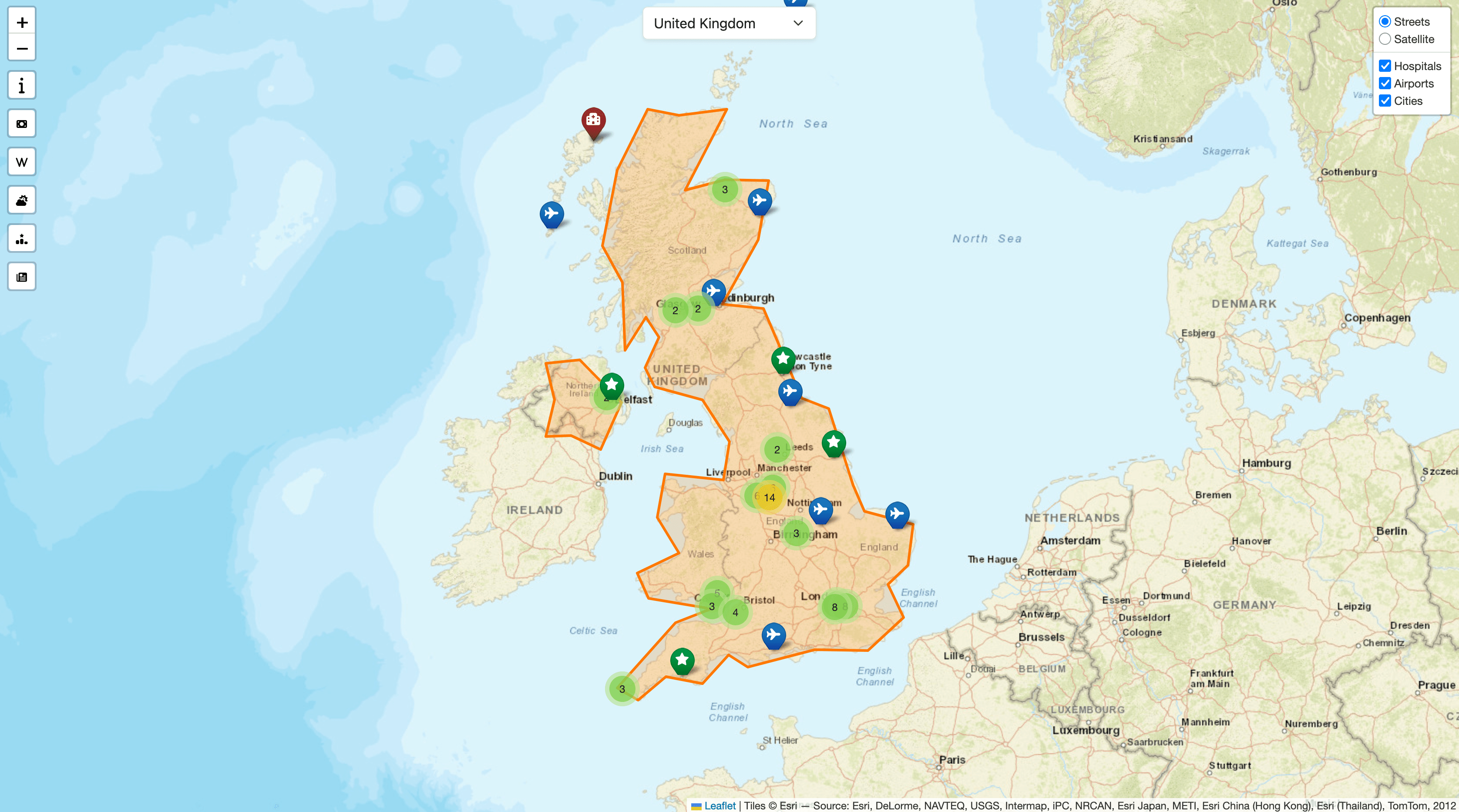
For this project, I was asked to make a mobile-first gazetteer system that would allow the user to select various countries and use APIs to gather relevant information for those countries.
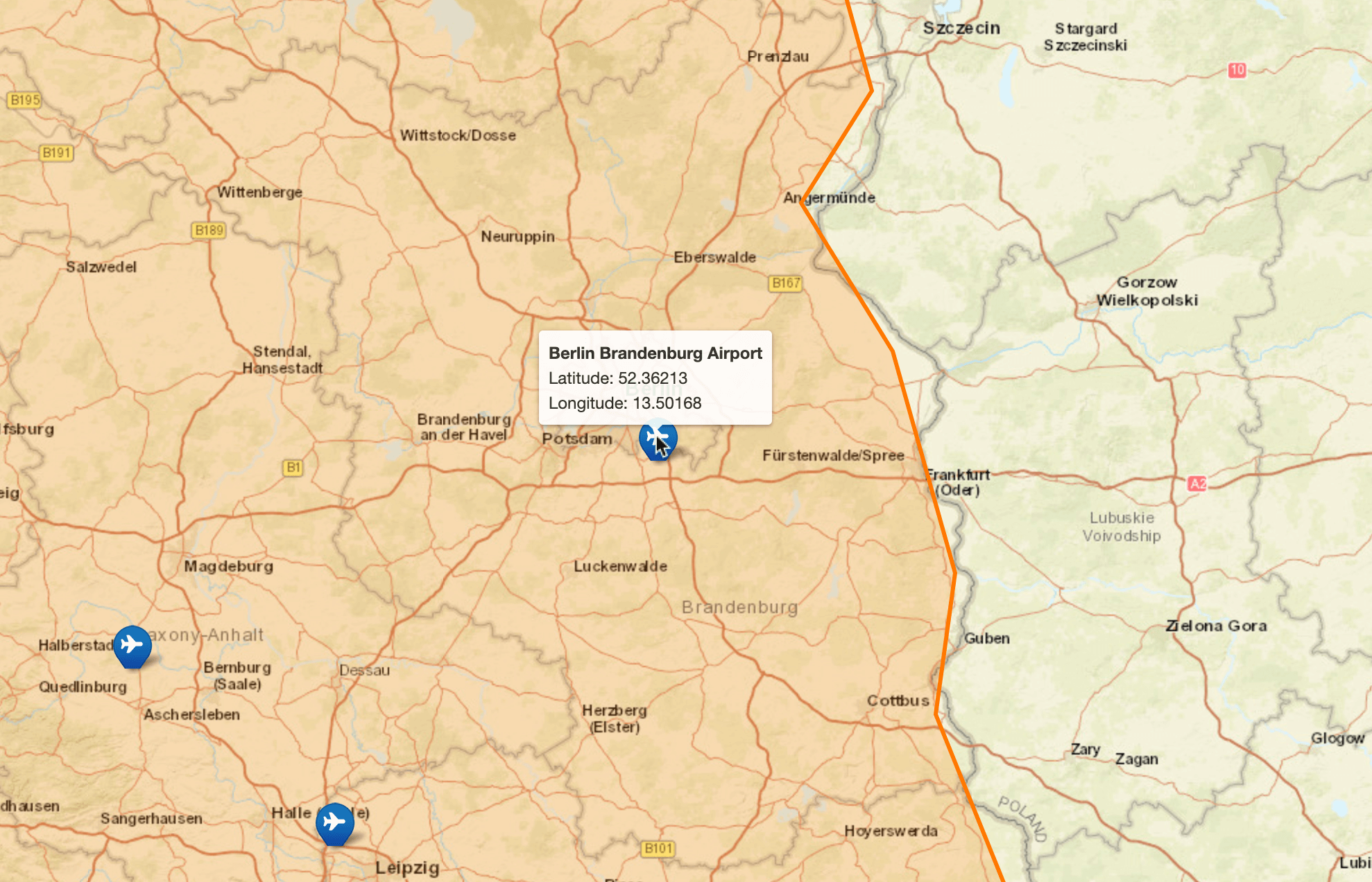
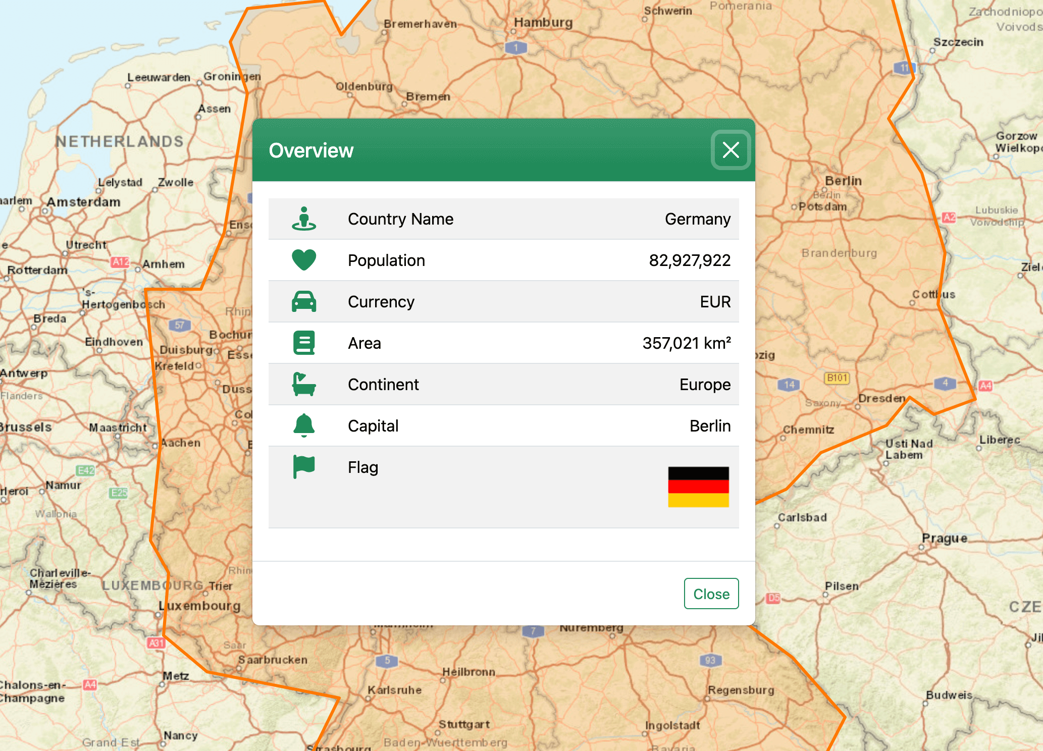
I was given a json file containing a list of countries and their borders stored as polygons. I used this file to populate a dropdown for country selection. I then used browser geolocation to ask for the user's coordinates and then determined which country they were in by checking which polygon contained those coordinates, and Geonames API to determine which country the user was in. From there, country borders could be drawn and requests could be sent to various APIs to gather additional information.
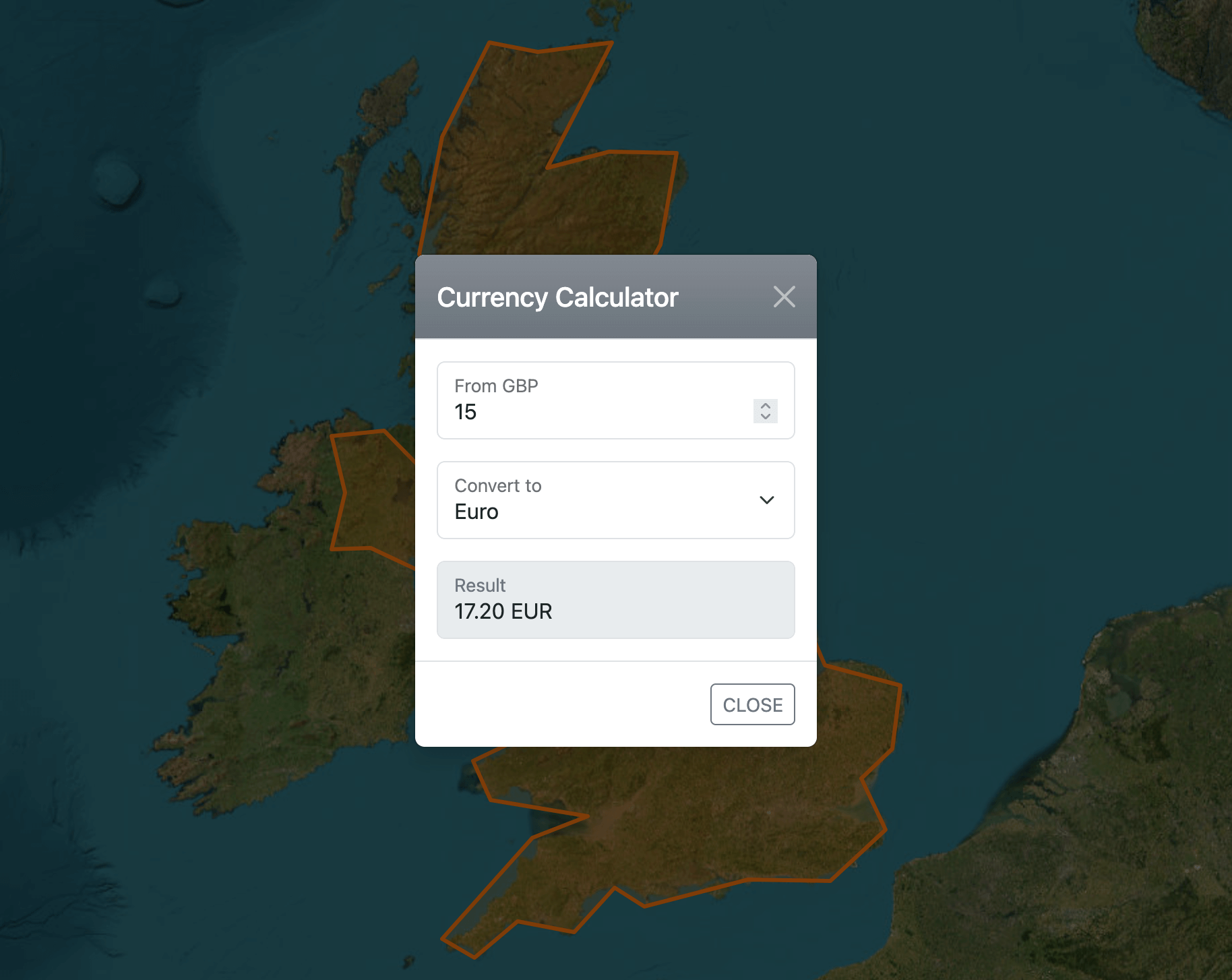
This project involved a lot of JavaScript, jQuery, AJAX and PHP. The APIs I used were geonames.org, openexchangerates.org, openholidaysapi.org, newsdata.io, openweathermap.org and wikidata.org
Project information
- Category Web design
- Project date November 2025
- Project URL www.georgegibb.co.uk/gazetteer
- Visit Website